Olivia Harne
Olivia Harne is a GIS developer and writer, who promotes the digitization of Americans with Disabilities (ADA) maps.

What are the current challenges facing ADA compliance in Pennsylvania?
The biggest problem I see facing ADA compliance in Pennsylvania is the lack of both standardization and archival policies regarding geodata. Locations that have a certain level of public assumption to provide visitors with accessibility data - places like larger national parks, museums, or universities - can get by with simply placing a jpeg or document file of a map on their website. When that happens, the responsibility is placed on the individual to print out and carry that map around. These organizations can skirt by on what I feel is minimal effort.
Pennsylvania places far stricter standards on agencies that provide maps on recreational activities, like fishing and hunting, which can be seen in the data provided by government organizations to the Pennsylvania Spatial Data Access (PASDA). While those are important in their own way, the large divide of expectation between recreational activities and information on helping people with disabilities get around comfortably is faulty.
After talking with an individual at the Bureau of Planning in Harrisburg, I found that not even our state capital keeps many cohesive records on sidewalks or accessible entrances, even though the city itself is relatively small and some of this data could feasibly be gathered.
How are people with disabilities affected by these shortcomings?
Allowing public spaces to place minimal effort into their accessibility maps means that individuals with mobility problems are inconvenienced unnecessarily. The lack of organizations willing to submit their geodata to PASDA, or onto platforms like ArcGIS Online, is also a problem.
In my mind, the state should require complete transparency on these maps, allowing those with disabilities to interact with and take relative ownership of data that applies to them. Organizations that treat this data as an afterthought should be taking a more active role in empowering the people that data affects.
Can you tell us more about your work on improving accessibility through mapping?
I think accessibility mapping could be vastly improved by transitioning most currently available data onto an online format. This way it's easily transferable, and in the case of sites like ArcGIS Online or Google Maps, placing this information onto those platforms enables a certain level of mobile adaptability to them. The configurable pop-ups available on those sites also help those who rely on text-to-speech programs.
One of my volunteer efforts is converting current document or image based maps to those sites, for organizations that want to add greater convenience to their current ADA compliance information. Any public space in Pennsylvania with an accessibility map is free to send it to me, and I'll create an online version for them.
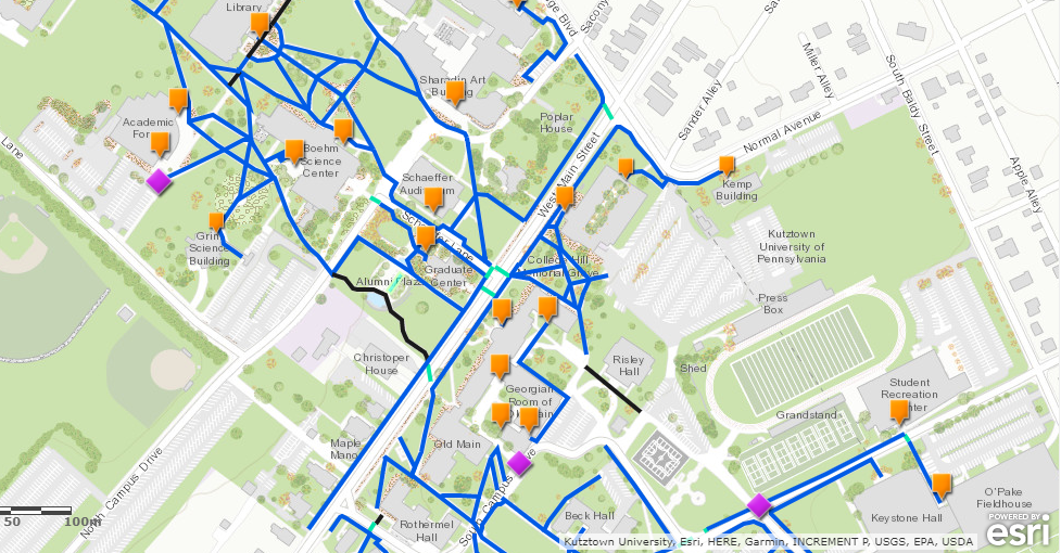
An interactive version of this map can be viewed on ArcGIS Online.
That’s awesome, what sort of feedback have you received from the community?
I participate in geography conferences in my state when I can, usually centering my talks on online GIS and accessibility mapping. I think those who are very invested in the field think that these platforms are too simplistic to be worth their time, but simplicity is how to reach out to those who may be interested in mapping to help others, but don't want to devote all their time to it. Using a standardized, "out-of-the-box" platform like AGOL or Google Maps is also far more useful and less tedious to update in the long run than customized, programmed applications.
What are the steps you are taking to bring about change?
I've been trying to help out in a few ways. Firstly, I've written to representatives in the state, to inform them about this lack of policy. Secondly, I have been speaking with PASDA, about potentially allowing a category for accessibility data, as well as sending them data from interested organizations that may want to contribute their maps for archival. As mentioned, I offer to convert public maps into an ArcGIS Online format for these organizations.
Who are your inspirations?
My supervisor while I interned at the PA Department of Transportation, Kristin Warner, allowed me to work a lot with creating ArcGIS Online story maps and applications. Her individualistic, self-sufficient approach to GIS has also helped me model the way I conduct my correspondence for accessibility mapping.
I've also been inspired by reaching out and speaking with individuals who navigate the world in different ways. My fieldwork adviser, Dan Stafford, directed me towards useful resources for Americans with Disabilities Act Standards. Specifically, the ADA 2010 Accessible Design Guide has helped me learn about the expectations for first person navigation. I refer to it when I'm creating maps fairly often. I think it's important to create GIS content for accessibility with a first-person view in mind.
Your advocacy for folks with disabilities through GIS is powerful. What does the future hold for geospatial activism?
I think geography in activism has a broad role to play. Ideally, the greater amount of people who have access to free services for crowd sourced mapping, the more demographics will be able to benefit from it - from preserving cultural identities to enabling safer navigation.
However, I think there's a certain level of transparency needed with technology that gathers individual locations. As highlighted by the recent New York Times article about Facebook and Cambridge Analytica, businesses seem to take advantage of fine print to farm personal information - such as addresses - from their users. People should be able to contribute to public mapping when they wish, while still being able to feel entitled to a certain level of privacy for data they don't want to share. As long as the expectation of privacy isn't treated seriously, it could be a barrier to geographic data playing a complete, trusted role in activism.
Are there some good examples of cities that are getting accessibility mapping right? I’m curious to know what the golden standard looks like or if there even is one.
Seattle, Boston and Washington DC are doing some interesting work in the accessibility mapping space. They have a fair amount of accommodation in terms of public transport, usually aimed towards tourists. AccessNow and AXS Map are other good examples I've seen of crowd sourcing geographic data for the purpose of accessibility. There’s a great article that recently came out talking about these start-ups as well as the role giants like Google and Yelp are playing in data driven accessibility mapping.
If you could display one message in the sky for all to see, what would it say?
"Take chances on your own ideas."
Interview conducted by Kelsey Kaszas with Epic Land Solutions, Inc.